Rossend Estate 1814. This map is on silk and can be viewed at the Heritage Centre
This plan is based on a survey carried out in November 1814, when it formed part of a property transaction.
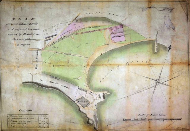
Links and surrounding area map of 1815
This map was prepared in 1813 as part of the evidence in a case at the Court of Session. There are some interesting features, such as dunghills and golf holes.
Burntisland in 1843
Plan of the Burgh and Municipality of Burntisland from Survey, annotated ‘Burntisland School’ at the top left of the map and ‘Walter Davidson 1843’ under the 'Geological Section' box on the map. What little we know of Walter Davidson comes from Burntisland historian Robert Livingstone: 'On 7th August 1818, Walter Davidson, son of the schoolmaster, was appointed as assistant teacher [in the Burgh School] and succeeds his father on 23rd October, 1833. On 6th August, 1835, the Council expressed disapproval of the mode of punishment administered by Davidson, but by 27th October, they recommend Davidson to receive everyone offered him as a pupil. Walter died on 8th May 1856.'
Plan of Burntisland by J. Wood, 1824
Broomhill, Burntisland, in 1840
Dated March 1840, a feuing plan of Broomhill (Mount Pleasant) illustrating the property of Alex J. Beatson Esq. and the proposed development for Mount Pleasant. This plan is printed on silk and can be viewed at the Heritage Centre
Burntisland - 1899 Plan
This 1899 plan of Burntisland is from a property disposition relating to sale of seabed to Burntisland Harbour Commissioners.
.jpg)

.jpg)
.jpg)
.jpg)
.jpg)

