Burntisland's geology is shaped by ancient volcanic activity, dating back to the Carboniferous Period, around 300 million years ago. The town is dominated by The Binn, a volcanic vent that has influenced the landscape and even provided shelter from cold northerly winds. The area features igneous rock formations, including basalt and dolerite, which appear as ridges and lava flows. Some of these rocks have columnar jointing, similar to the famous Giant’s Causeway, though on a smaller scale.
Additionally, Burntisland has several volcanic necks, forming an arc around the town, indicating significant igneous activity in the past. The region also contains sandstones, with traces of coal discovered during historical mining operations, shales, and thin limestone layers
Burntisland and the surrounding Fife region have a rich geological history, dating back to the Carboniferous Period. Fossils found in the area include marine invertebrates, such as brachiopods, corals, and crinoids, which thrived in ancient seas that once covered the region. Some fossilized remains of fish and plant material have also been discovered in sedimentary rock layers.
The Lower Limestone Formation in Fife contains fossil-rich limestone beds, which have preserved traces of prehistoric marine life. While Burntisland itself is better known for its volcanic geology, nearby locations in Fife, such as Dura Den, have yielded well-preserved fossil fish from the Devonian Period
The Geology of Burntisland
by Keddie Law
Text and photographs provided by Keddie Law.
The Hills of Burntisland
At a mere 632 feet (174m), it can hardly claim to be amongst Scotland's giant hills, yet the Binn (Hill), visible from almost every point in Burntisland dominates the town. The steep slope of the Binn is made up of basalt and in places this rock formed columnar jointing as it cooled.
Below the Binn the first of many east-west running ridges encountered stretches from the site of the Greenmount Hotel, along Black Jock's Hill, facing the Toll Park and continues along the back of the- Aberdour Road.
Much of the landscape of the Burntisland area — certainly the hilly parts — owes its shape to the volcanic activity which originated in the volcanic neck represented by the Binn. In terms of age, we are looking back at events that occurred some 300 million years or so ago during the Carboniferous Period.
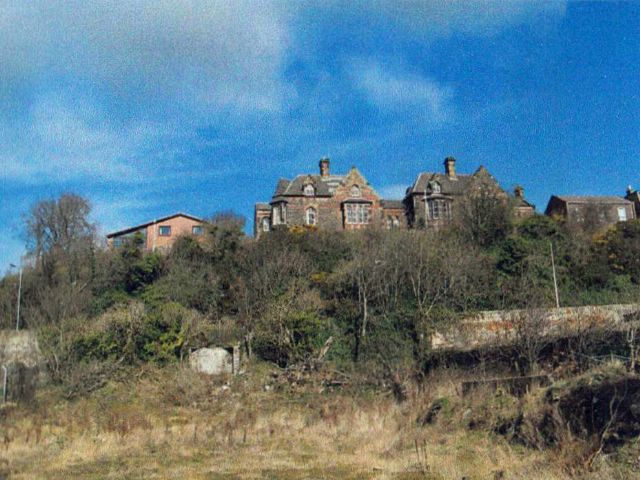
Broomhill
The Lammerlaws
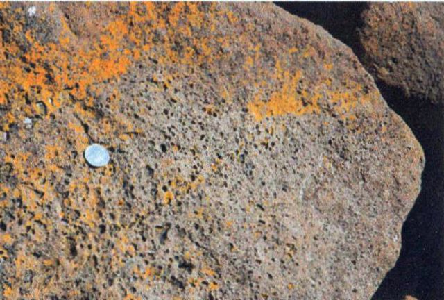
Another exposure of dolerite is the Lammerlaws Promontory which has an eastern extension in Burntisland Bay represented by the Black Rocks outcrop. At the Lammerlaws the dolerite is badly weathered, displaying a typical reddish-brown colour as the iron oxide in the rock is exposed to water and a It appears that the area of dolerite at the Lammerlaws was once far more extensive than it is today. Historians tell us that in the late 19th century the Lammerlaws area was used as a source material for the huge blocks of dolerite which make up the breakwater between the Lammerlaws and the dock entrance. Close examination of the faces of some of these dolerite blocks shows the presence of tiny holes, resembling a slab of gruyere cheese. These holes, termed vesicles, are caused by escaping gas bubbles and tell us that the vesicular lavas were formed at, or close to, the surface, since the gas would not have been able to escape had it been trapped by overlying rocks.
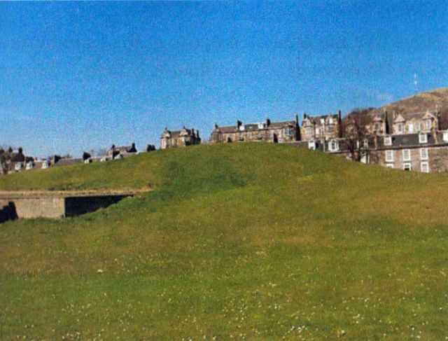
The Big Knowe on Links
Sandstone Deposits
Outcrops of sandstone in the Burntisland area are rare. In most areas buildings or farmland obscure the nature of the underlying rock. This does not mean that sandstone cannot be seen in Burntisland. On the contrary, a simple examination of many of the burgh's older buildings reveals sandstone as the main building material. Most of Burntisland's best known buildings were built of grey sandstone: the Public Library, the Erskine U.F. Church, the former Primary School in Ferguson Place (closed 2014) and many residential buildings.
10p coin gives scale to the tiny holes in the dolerite caused by escaping gas
Spheroids
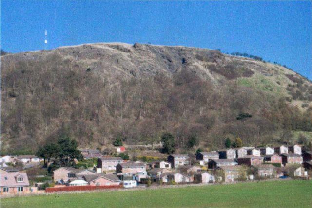
Volcanic vent of the Binn Hill
In Burntisland proper there are several ridges of higher ground, all composed of either basalt or dolerite and these represent either lava flows or igneous intrusions such as sills.
Burntisland is a remarkably hilly town. Anyone who has toiled up Broomhill or Craigkennochie cannot be unaware of the steep ridges they occupy. Less obvious, but of the same volcanic origin, are the uphill routes to the railway station from the High Street via the Kirkgate, or the double climb from the High Street to the Toll Park via Cromwell Road.
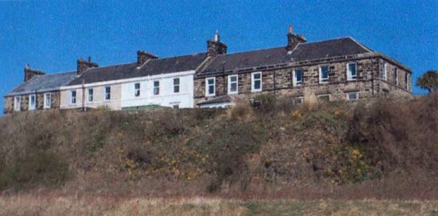
Bassalt ridge of South View
The Links
. Not all the igneous outcrops in the town are large, as witness the small hill on the Links, inaptly named the Big Knowe. Some 50 yards to the west of the Big Knowe there is a small exposure of the hard rock (cover photo) which is the basis of the hill. The houses perched on the igneous outcrop overlooking the old railway marshalling yards behind the breakwater look to the old Parish Church sitting on the bluff by the sill. This steep-sided outcrop then continues westwards to Rossend Castle.
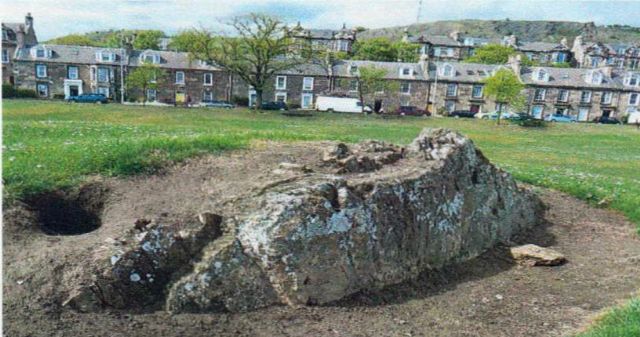
Small Knowe
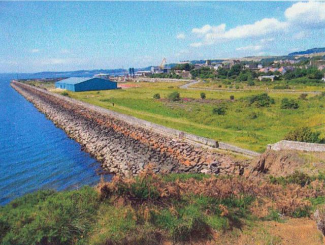
Breakwater created from basalt ridges of Lammerlaws
Glossary of Geological Terms
Select Glossary of technical terms
Basalt: igneous rock similar to, but finer grained than dolerite and often associated with lava flows
Carboniferous Period: geological time period which occurred around 280-345 million years ago
Columnar jointing: under certain conditions basalts form columns of rock as they contract on cooling
Dolerite: an igneous rock often associated with volcanic sills
Igneous: term applied to a once molten rock
Sedimentary rock: rock formed from the disintegration of other rocks, or from organic remains. Typically such rocks are much softer than igneous rocks and are more easily worn away
Sill: igneous feature formed when molten rock is squeezed
between other, usually sedimentary rocks
Spheroidal weathering: process of weathering (also
known as onion-skin weathering) where the layers of
rock peel off like the layers of an onion
Volcanic neck: a lava-filled passage at or near the surface
of an extinct volcano
Weathering: the process of decay and break-up of rock caused by physical fracturing or chemical decomposition
© Text and photographs by Keddie Law, 2011,2014
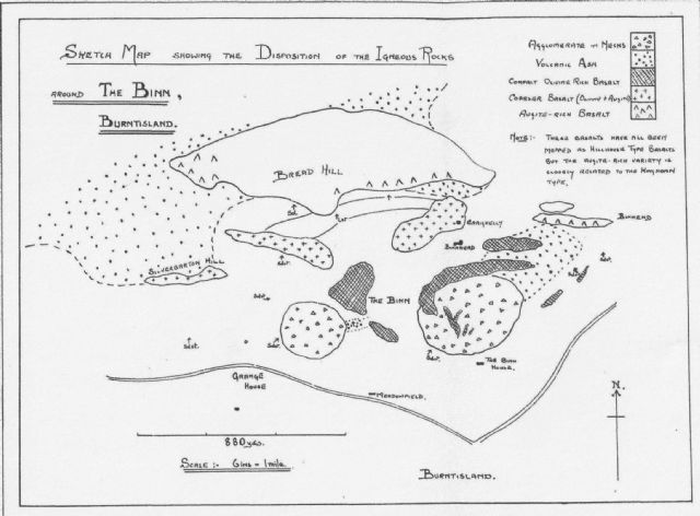
The Igneous Geology of Burntisland. Transactions of the Royal Society of Edinburgh, vol. 53, part 3, 1924.

